Berlin, Germany · 6 min read
Berlin wears its history on the surface in a way few cities dare. Nowhere is that layering more intense than the stretch of pavement running south from Checkpoint Charlie — a few hundred metres where a Cold War checkpoint, a Nazi ministry built to intimidate, and the excavated ground of the Gestapo headquarters sit almost within sight of one another.
If you're trying to decide whether this corner of Berlin is worth your time, here's the short answer: it's one of the most concentrated history walks in Europe. You don't need a full day or a guided group. In under half an hour of easy walking you pass through imperial Prussia, the Third Reich, the East German state, and the divided city of the Wall years.
This guide picks out what makes each stop matter — and points you to a free self-guided audio tour that ties it all together as you walk.
The Most Photographed Border on Earth
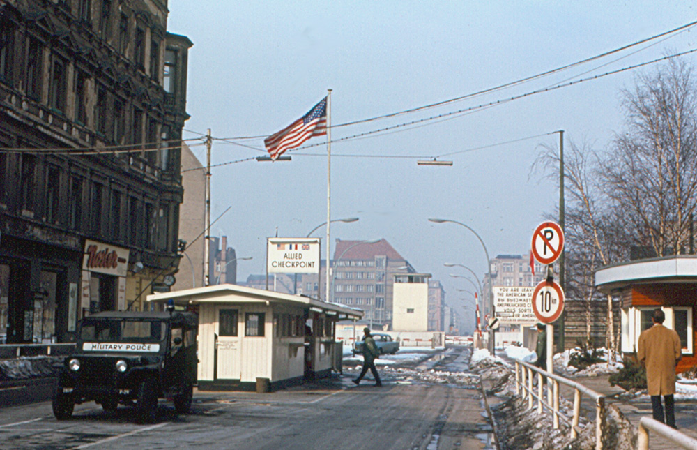
Checkpoint Charlie is where most visitors begin, and it's worth knowing before you arrive that much of what you see is theatre. The white guard hut in the middle of the road is a replica, and the uniformed 'soldiers' posing for selfies are paid performers. The real crossing — Checkpoint C, 'Charlie' in the NATO alphabet — was grimmer, reserved for Allied personnel and foreigners moving between sectors.
Strip away the kitsch, though, and the ground is genuinely extraordinary. In October 1961, American and Soviet tanks faced each other here barrel to barrel for sixteen hours, engines idling, over a dispute as seemingly small as whether a US diplomat had to show his papers to cross. One nervous order and the Cold War could have turned hot on this exact asphalt.
The famous sign still reads 'You are leaving the American sector.' Stand in the noise and the souvenir stalls for a moment and the point lands: the line under your feet once decided who was free to walk across it.
Göring's Ministry and the Uprising It Outlived
A short walk on, a vast grey stone block stretches the length of the street — relentless, deliberately intimidating. This is Hermann Göring's Reich Air Ministry, completed in 1936 and, at the time, one of the largest office buildings in the world. It was designed to awe, and it still does. Remarkably, it came through the wartime bombing almost intact while the city around it burned.
Its afterlives are the real story. The Nazis ran their air war from these corridors; then the new East German state simply moved in and ran its ministries from the same rooms. On 17 June 1953, construction workers and ordinary citizens gathered out front demanding better conditions and free elections. Soviet tanks crushed the uprising and dozens were killed.
Look for the photo memorial set into the ground — a real image of that 1953 crowd — positioned to face a cheerful GDR mural of happy workers. Propaganda and reality, staring each other down in a single courtyard. Today the building houses the Finance Ministry, perhaps the quietest possible fate for such a loud piece of architecture.
A Parliament Beside the Death Strip
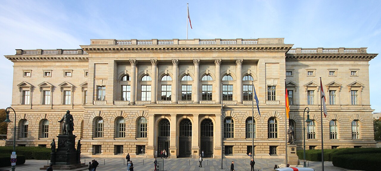
The former Prussian Landtag offers a different kind of grandeur — ornate, columned, confident. It opened in the 1890s when Berlin was the capital of a rising empire, and today it serves as the Abgeordnetenhaus, the parliament of the state of Berlin, doing democracy's ordinary daily work behind a handsome façade.
The revelation here is the street out front: Niederkirchnerstrasse. For twenty-eight years the Berlin Wall ran right along it. This elegant parliament building sat just metres from the death strip, its windows looking out onto concrete and guards.
It's an easy building to walk past, but standing here you're reading several Germanys stacked on top of one another — Prussian monarchy, Nazi dictatorship, a divided city, and a functioning parliament. The same ground keeps changing masters.
The Architecture of Repair
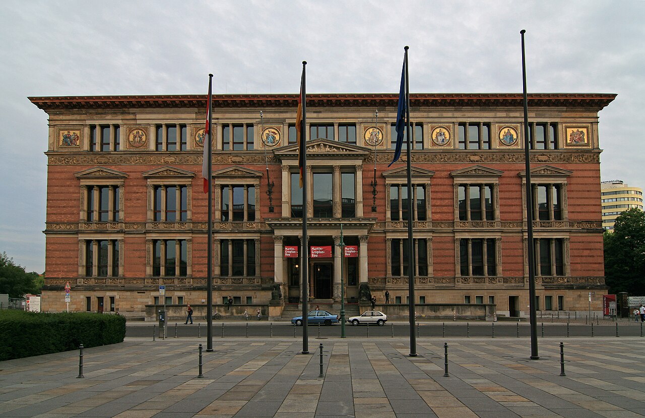
After so much architecture of power and fear, the Gropius Bau comes as relief. Warm terracotta and gold, mosaics, obvious craftsmanship — it opened in 1881 as a museum of applied arts, designed by Martin Gropius, great-uncle of the Bauhaus founder. It was built to celebrate making things beautifully.
The war gutted it, and for decades afterwards it stood as a scorched ruin stranded in the border zone beside the Wall — too damaged to use, too awkward to reach. Most assumed it would be demolished.
Instead, Berliners rescued it, slowly and stubbornly, through years of restoration. Today it's one of the city's great exhibition halls, full of light and visitors. On a walk defined by power and terror, this is the architecture of repair: proof that a place scarred by two dictatorships can be mended into something generous.
Where Two Dictatorships Overlap
The walk ends at the Topography of Terror, and it's deliberately not comfortable. Above runs one of the longest surviving stretches of the original Berlin Wall. Beneath lie the excavated cellars of the building that once stood here: the headquarters of the Gestapo, the SS and the Reich Security Main Office.
This is where the machinery of terror had its desks. From offices on this spot, surveillance was organised, torture was carried out in the cellars below, and the administration of the Holocaust — the murder of millions — was planned as paperwork. There is no grand monument, and that's intentional. Just exposed foundations, gravel, and documentation panels laying out victims and perpetrators plainly, so you cannot look away.
Notice where you've arrived: the Wall overhead, the Gestapo ruins below, two dictatorships overlapping on a single patch of Berlin earth. One regime's ruins became the next regime's border — the whole theme of the walk compressed into one quiet, unforgettable place.
Good to know
The route runs about 0.6 miles (roughly 1 km) from Checkpoint Charlie to the Topography of Terror, with five stops and around 25 minutes of audio — allow an hour or more if you pause and explore. The path is flat and fully paved, easy in any weather. The Topography of Terror is free and open daily 10:00–20:00 (check holiday closures), with both indoor and outdoor documentation. Bring comfortable shoes, headphones for the audio, and time for quiet reflection at the final stop.
The easiest way to connect these layers as you walk is the free self-guided audio tour 'Checkpoint Charlie to the Topography of Terror,' which narrates each stop in order at your own pace. Press play at the checkpoint, follow the line south, and let the story of one much-contested patch of Berlin unfold under your feet.
Take the free tour: Checkpoint Charlie to the Topography of Terror →